In a two-week period in late May and early June, three farms with 748 acres joined the Jefferson County Farmland Protection Program. The Magaha, Ware and McKee families signed their deeds of conservation easement for their properties, completing the process to protect their lands in perpetuity.
The new easements increase the amount of protected farmland in Jefferson County to 5,455 acres on 48 farms. More than 90% of the newly protected lands include prime and statewide important agricultural soils. The USDA Natural Resources Conservation Service (NRCS) and the Jefferson County Farmland Protection Board provided funds to purchase the conservation easements.
“This is a momentous milestone for our organization,” said Robert Glenn, President of the Board. “With the addition of these three working farms, the county has made a significant step towards our vision of a future where we have protected 20,000 acres of the remaining prime and important agricultural soils in Jefferson County.”
The 278-acre Borden Farm lies almost entirely within the boundaries of the Core Area of the 1862 Civil War Battle of Shepherdstown and borders 3,000 feet of Rattlesnake Run that feeds into the Potomac River. The land constitutes Confederate General A.P. Hill’s position in the September 1862 battle where Hill’s forces dislodged Union troops who had pursued General Lee’s army after the Battle of Antietam. The farm pastures cattle and horses and produces hay.
Jim Lighthizer, President of the American Battlefield Trust remarked, “The Trust is thrilled to have been a part of the protection of the Borden Farm at Shepherdstown. That engagement, the final clash of the Antietam Campaign, represents a critical moment in the Civil War’s progress. And I believe that this activity, representing the largest single acreage yet protected on this important battlefield, will also become a moment of note in the story of its preservation.”
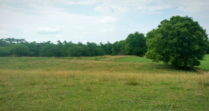
In the Charles Town District, the 190-acre Magaha property fronts on Middleway Pike and lies entirely within the boundaries of the Civil War Battle of Summit Point of August 1864, that occurred at the beginning of Union Major General Philip Sheridan’s Shenandoah Valley Campaign. Confederate Lt. General Jubal Early and Confederate Major General Richard Anderson attacked Sheridan’s Union forces over lands including the Magaha farm. The farm produces grain crops, hay and cattle.
The 280-acre Ware property lies a few miles north of the Magaha Farm on Darke Lane and produces grain crops and hay. Rick Ware said, “We appreciate the Farmland Protection Program, which has made it possible to ensure the legacy of our family’s farm. Our parents would have been so happy to know that the farm they passed on to us will not be developed.”
According to the Census of Agriculture, between 2012 and 2017 Jefferson County lost 852 acres of farmland to residential and commercial development.
“It has never been more important to preserve farms and sustain our agricultural heritage if we are to remain a viable agricultural economy,” stated County Commissioner Jane Tabb. “The Farmland Protection Program enables us to support our local farmers and protect our quality of life.”
Jefferson County’s continued commitment to farmland protection is reflected in its most recent comprehensive plan. The January 2015 Jefferson County, WV Envision Jefferson Comprehensive Plan, states, “One goal of this Plan is to maintain productive farmland soils and the rural character and economy of the County by reducing the conversion of farmland to non-agricultural based uses.”
“Protecting our county’s farmland goes hand in hand with protecting the quality of life in Jefferson County,” said Elizabeth Wheeler, the Board’s Program Director. “Local farms provide us with healthy food, support a diverse economy, and protect water supplies, wildlife habitat and the scenic and historical landscapes that make Jefferson County such a beautiful place to live and visit.”
About the Jefferson County Farmland Protection Board
The Jefferson County Farmland Protection Board was established under a state law passed in 2000 that allows West Virginia counties to levy a transfer tax on real estate to purchase development rights from landowners who wish to protect their land for agricultural purposes.
An agricultural conservation easement is a voluntary, legally recorded deed restriction that is placed on a specific property used for agricultural production. It is a flexible legal tool that enables landowners to permanently protect the agricultural, natural, scenic and historic values of their property from development and subdivision. Property owners retain full use and ownership of the land. Because an easement is perpetual, it is transferred with the property when the property is sold, thereby forever protecting it. For more information about the Jefferson County Farmland Protection Board, contact the Board at: 304/724-1414 or jefferson@wvfp.org.